3D laser scanning of a residential building – digital as-built survey for precise further planning
Project overview
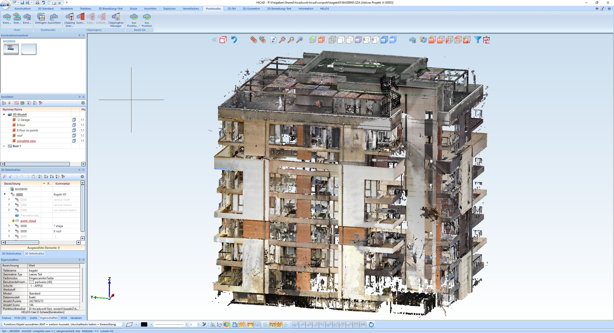
A complete 3D laser scan was carried out for a multi-storey residential building in Tbilisi (Georgia) – both inside and out. The aim was to create consistent digital as-built documentation that would serve as the basis for architectural adjustments, trade planning and subsequent conversion and execution processes.
The resulting point cloud provides an exact geometric representation of the entire building and enables reliable further processing in modern CAD and BIM systems.
Initial situation
The existing building documents were only available in fragmentary or incomplete form. However, a precise digital basis was required for the upcoming planning and furnishing processes, which:
- maps exact dimensions, axes and component geometries
- makes installation areas, shafts and cable routing visible
- reproduces spatial geometries and height ratios in detail
- Detects discrepancies between existing and previous plans
Without this basis, reliable planning would not have been possible.
Carrying out the laser scan
The entire building was surveyed in several stages using a FARO laser scanner. The following were recorded:
- Outer shell and facades
- All floors, rooms, stairwells and balconies
- Installation shafts, supply technology and relevant fixtures
- Roof superstructures and technical upper floors
- Site connections and surrounding areas
A coherent, colored point cloud was generated from the individual stations, which fully documents the real condition.
Further processing in the CAD system
The point cloud was imported into HiCAD and served as a working basis for:
- Derivation of precise as-built plans
- Elaboration of individual trades according to the client’s specifications
- Collision checks and geometric checks
- Component-specific modeling for architects and interior designers
The processed data was handed over to the customer and the project partners in a structured form.
Cooperation in the project team
A key feature of this project was the international project structure.
Several specialist disciplines were involved in the implementation, not all of which worked at the same location.
By creating a complete digital twin, all those involved in the project were able to:
- Access identical, precise inventory data
- Collision-free and geometry-safe planning
- Making decisions across locations
- Continue working without measurement errors or uncertainties
- seamlessly coordinate their trades
This created a framework in which an international working group could work together professionally, efficiently and synchronously – despite the physical distance between the teams.
Internationality and digital precision
This project impressively demonstrates how modern 3D capture technologies can connect international planning processes.
Collected on site in Georgia.
Processed and modeled in Austria.
Used by architects, planners and contractors at various locations.
The result is an end-to-end digital twin of the building – the ideal basis for conversions, extensions, modernizations and furnishing concepts.
Conclusion
The complete building scan provided the necessary data depth for reliable planning decisions.
The combination of a realistic point cloud and precise CAD processing provided the customer with a reliable digital building stock that offers all project participants clear geometric orientation and minimizes planning errors